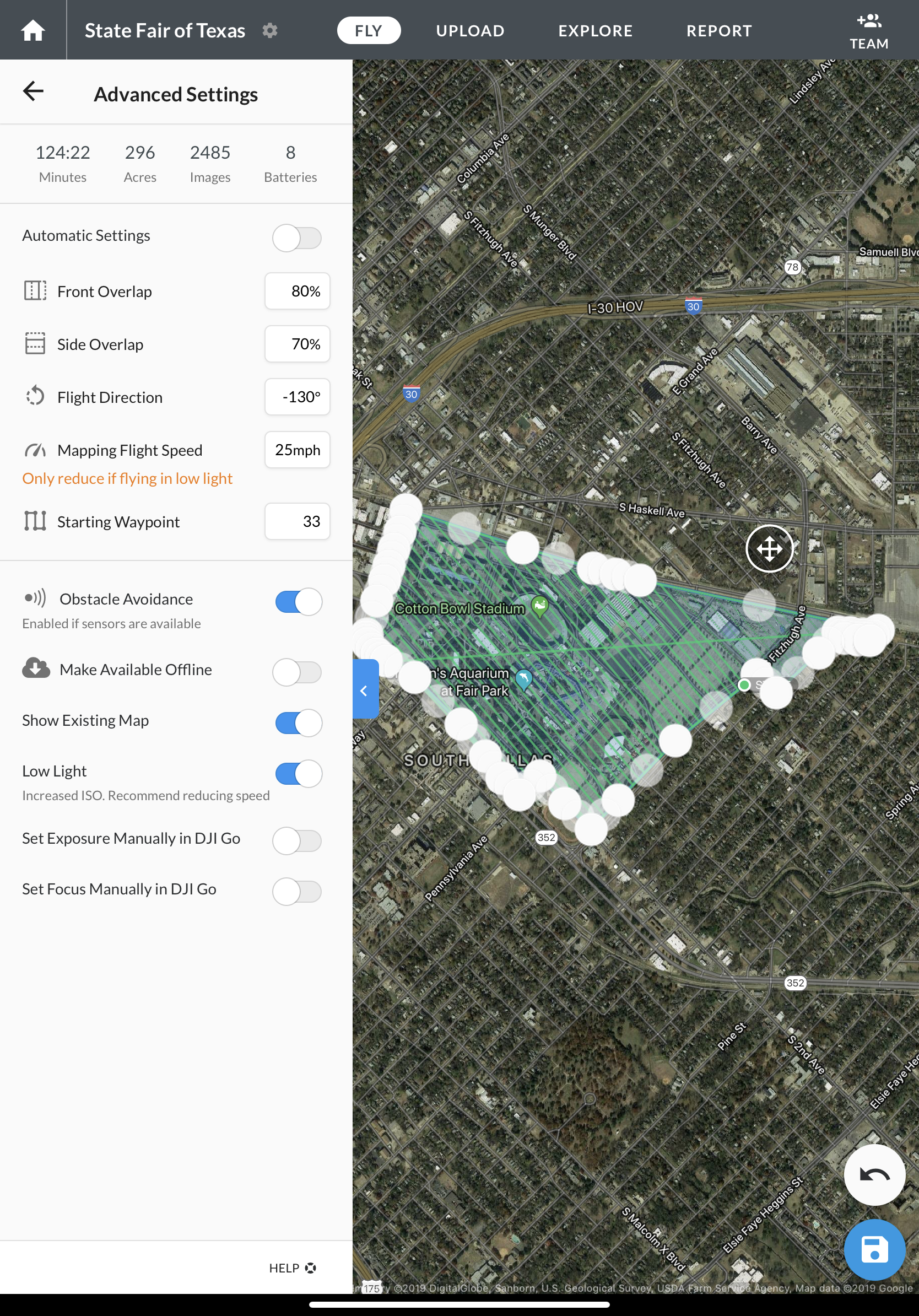
I might have a mapping project come up for around 280 Acres.
This would be over some buildings in ClassB air space.
My concern is keeping quality of doing a 3D map on Drone Deploy.
I will have some one story builds and some buildings all the way up to 1000 ft per info given in VFR Charts.
If you have a lot of variations in height during mapping how will this affect the quality?
Any suggestions on maintaining quality.
I also when I create the plan it says it will take 2530 pictures. When I ran the simulator it took over 3000 pictures. Which one is closer to being accurate?
Just a quick look and it looks like the Class B like you said, but there is also another airport to notify coming from the southeast and two schools. Unfortunately the airspace elevation grid shows a 100ft cap over the whole park so keep you fingers crossed. Looking at the VFR map the highest structure is 596ft AGL, I think you might have looked at the MSL.
When I guessed at the extents and put it in DroneDeploy I got 278ac so pretty close and at 200ft AGL and 75/65 overlaps I get the following. If they let you fly that high.
If you are more interested in a good 3D model I would suggest the Crosshatch method. First it allows an oblique camera pitch so your vertical faces will be much crisper. Also, running obliques allows for lesser overlaps. It’s pretty much the same stats, but you are coming at everything from 4 different directions. The optimized flight direction looks like 44 degrees.
Correct. Depending upon which plan you are on the upload allowances vary. You could contact support if you run into an issue, but in keeping with VLOS you might consider splitting the site into East and West halves. From there you can either upload all of the images into one map or process two maps and then combine them in QGIS. I hope you got a box of batteries!
You might take a look at where the highest obstruction is because you may be able to get your flight plan around it. I would be a little leery at running higher than 400 ft, especially with the restriction zones that you are dealing with. if you have to I think it would be okay too do three flights as you said. 1 structure mode over the stadium. This will allow you to minimize the number of parallel passes that you have to do and will definitely create a nice model.
There is an app called Auto Flight Modes. Crosshatch is the only one I use since the other two are basically the normal map plan and the Structure Mode. On the crosshatch you can change the gimbal pitch. I think it defaults to 65deg, but I normally pull it down to 55deg if I really want to capture the vertical faces and make a nice model. I wouldn’t advise usually GCP’s as it can cause some warping (not much) because of trying to tag at oblique angles.