Very helpful when creating missions from no information and also creating rough GCP’s. Install these to Google Earth. You right-click and refresh to update the point after getting it right in the middle of the object.
http://www.metzgerwillard.us/EarthSurvey.html
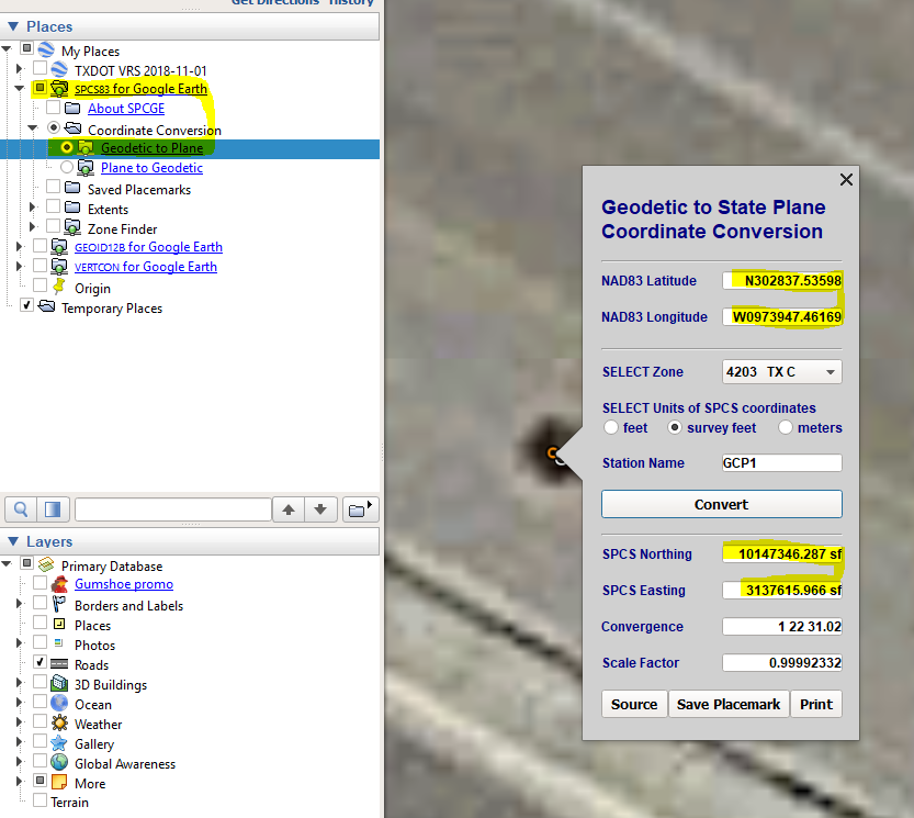
SPCS83 Example
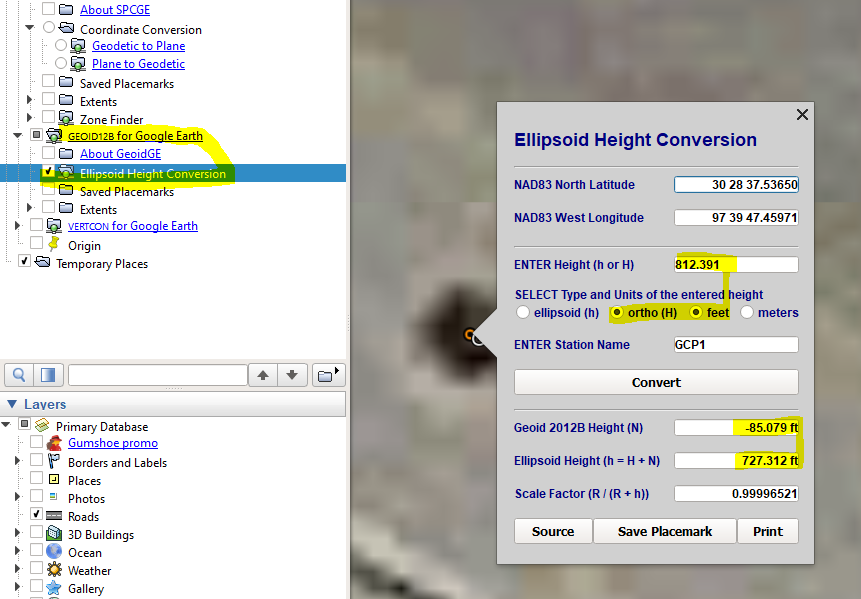
Ortho to Geoid/Ellipsoid Heights
2 Likes
Very cool. Have you had any maps that are in both central and south central plane? If so how would you process that in DD?
1 Like
Yes, you can tell by the CAD coordinates. Central is 3M,10M(X,Y) and South Central is around 2M,13M feet.
But how would you process that in DD? When you add GCP’s for processing you define the state plane. This is a first for me.
1 Like
Yes, your GCP file will be in the CAD coordinates so you just let it do what it does and export the correct EPSG at the end. Something to watch out for are scale factors which you will see if the linework comes in NE of a Google map then the GCP points derived from the CAD will also come in to the NE of the DroneDeploy plan. If this happens you need to get the WGS84 coordinates for the points convert the ground elevations to metric. I have decided to shoot everything by the network which always lines up in DD and GEP then do an alignment routing in CAD.