It would be really great if I could turn up and down the opacity of my base map to make it easier to see drawing overlays. This would also be a good feature to include when exporting PDF reports that include overlays. It’s just really hard to see the lines on any of my overlays.
2 Likes
Engineering is currently working on some things with overlays. We were having a really hard time with visibility as well. There is transparency to the line work which seems backwards to me. Usually in CAD. We darken the ortho so that we can see the line work better. The way we have been able to get better visibility on the line work is to make the line weights a little thicker. Currently we’re using 0.25 and 0.3 mm. Once they get the fix I am sure there will be some adjustment but hopefully this will solve our issues.
Hi Michael, I’m new to the forum do you work for drone deploy? I’m just curious? Glad to hear someone is working on improving overlays either way. I’ve thought about doing the same workaround in CAD but I find the bigger issue is that the base map is too vibrant to see the drawing in some areas. I would much prefer to be able to modify the opacity of the base map.
The functionality looks like it almost exists already. Under map details I can turn the base map on and off. This would just need to be turned into an opacity slider. Which from a non coder perspective sounds super easy, I’m sure it’s not.

Hey Erik, I am just a user/moderator. We’ve been with DroneDeploy for 7 years so it’s just part of what I do now. I am curious as to the effect you think is going to happen by making the ortho more transparent? In my experience, and this is another thing we have discussed with DroneDeploy at length is an exposure control. Like I said earlier we darken in CAD but there are some instances where it would be better to brighten it. It does seem like this would be pretty easy in comparison to some of the other things they have released recently. DDC is coming up so I am sure there will be some goodies unveiled.
1 Like
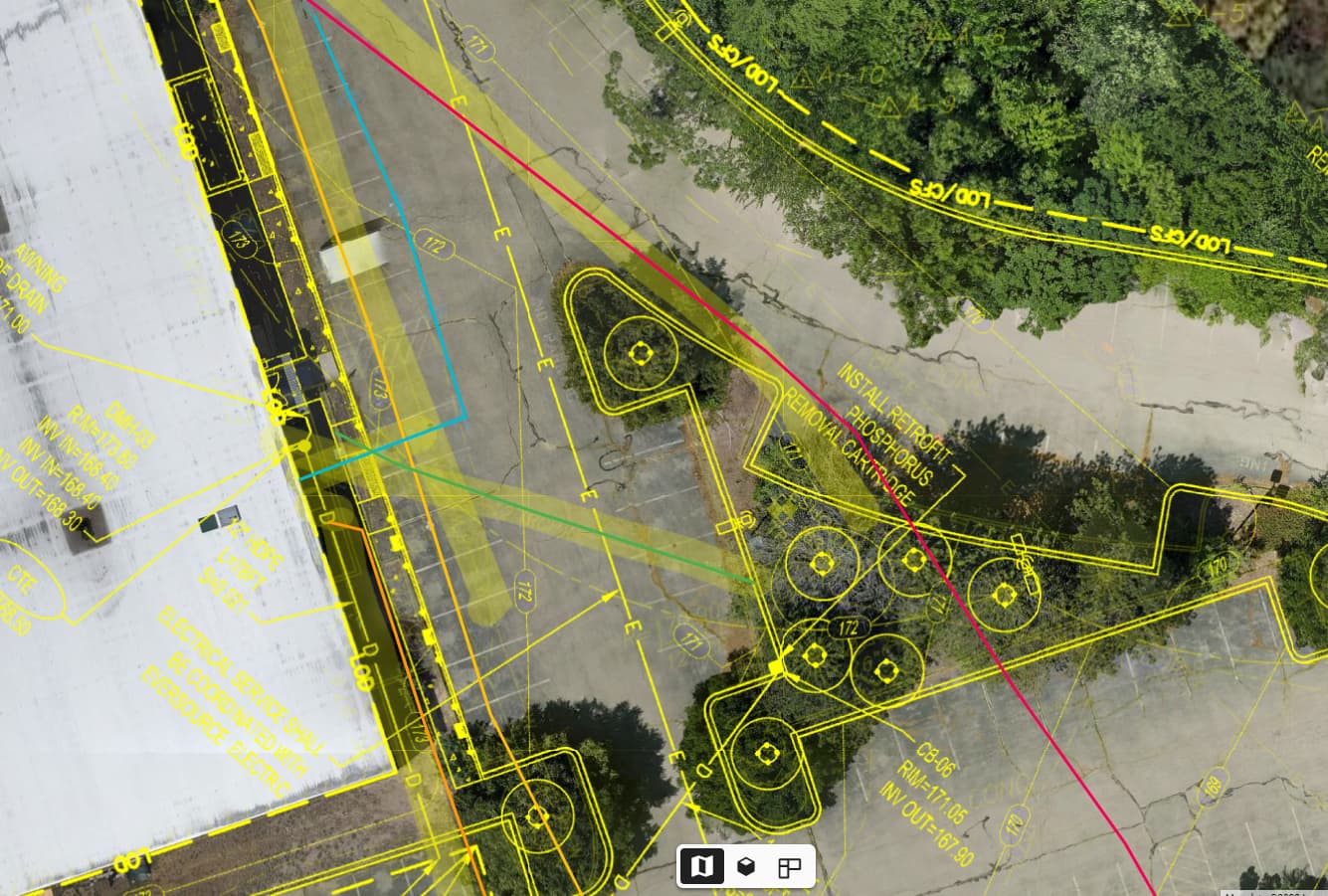
Hey Michael, so I’m running into a perfect example of the issue I’m hoping to solve right now. I flew a site with an existing building that is getting heavily retrofitted. We had a GPR company come out to flag and mark all the underground utilities around the site. I’ve been tasked to fly the site post GPR scan and verify the existing conditions utility drawing to the data that was collected in the field. Perfect use case for a drawing overlay right? I went and dropped location markers on top of any flags or paint in the field and now am tracing them out with the line tool.
The problem is that the existing utility lines shown on the drawing are faded out and difficult to see and the proposed new lines are bold. I know that I could change the line weight and upload a separate PDF to overlay but then I have to constantly toggle between drawings and do another overlay. My hope is that by being able to lower the opacity of my site orthomosaic I will be able to more clearly see the existing utility lines in the PDF and trace them out. This opacity function would need to carry over into the PDF report as well.
Image below shows how difficult it is to see the existing utility lines. So far things aren’t exactly lining up so it will be really important to clearly identify these discrepancies and get the information over to the design team.
Thanks!
For sure. This is definitely something that has existed for a while and I think they now understand what is going on so hopefully the engineers will be able to get us something fairly quickly. I have also found that because we like to use color-coded CAD files. We have had to change a few colors on anything lighter because when they remove the “transparent” white background it reduces the visibility of those colors as well.
I was about to create a new feature request, but thought I’d reply to this instead. We would like the base opacity to be feathered, instead of being on or off, it would be ideal if there was slider between 0-100% where the satellite base map could be faded, this would allow it be used for reference, but make the drone imagery stand out against the satellite base map. Having it 100% opaque, or 100% transparent (hidden) is not as effective.
1 Like