I am wondering if there is interest in supplying/presenting metadata for a video. Examples that I would like to see are:
-Georeferenced location overlayed on map while video is playing. Possibly a split screen or bottom right screen like 360 walkthrough.
-Speed and altitude of drone during flight.
-Screen capture of video. I would like to take a snapshot and zoom into the video within DroneDeploy.
I am interested in other ways DD could expand on video capture.
1 Like
A video where the viewer can manipulate the orientation? Like this? I’m pretty sure it’s been discussed but nothing to note. The side by side that 360 WT has would be cool as well. Maybe we’ll have measurements by then…
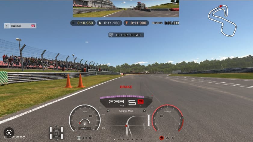
No, not looking to manipulate the information. I’m thinking more of what is depicted in this racing game. They utilize a map of where the vehicle is on the track. That is what i would like to see with drones. Where is the drone on the map in reference to the video. Also, adding speed and altitude would be nice.
2 Likes
Is that main view, rear view and overall plan? Are you using a 360 camera?
I think we are getting a little confused. Just talking about a normal video upload that is recorded by the drone.
2 Likes
For sure I’m not getting it. You can upload standard videos from any device. If you are also getting an SRT file it has all the coordinates. What drone are you using?
Probably nothing like what you’re looking for, but here’s a cool example of drone telemetry attached to video, as well as the drone’s position and field-of-view overlaid on a map. I think the operative term for the telemetry is “KLV data”.
(skip to about 1:20 for the drone feed w/telemetry)
That is what I am looking for. If DD could incorporate the KLV data with the video, that would be very helpful.